More than just signage, we view wayfinding as a set of experiences working in concert together to assist the user in orienting themselves and navigating to a specific destination.
Wayfinding Signage Design
Team Leaders
Project Inquiry
Contact Us ›
Wayfinding Design Services
Especially important within the built environment, wayfinding provides visual cues to help guide people to their destinations with ease and comfort. In addition to signage, our wayfinding design services include architecture, interiors, landscape, art, lighting, and graphics. The result is a more elegant and effective solution that meets the unique needs of our clients, their environment, and its users.
Process for Wayfinding Signage and Design Elements
Working in close collaboration with key stakeholders, we act as more than just wayfinding consultants—we are partners.
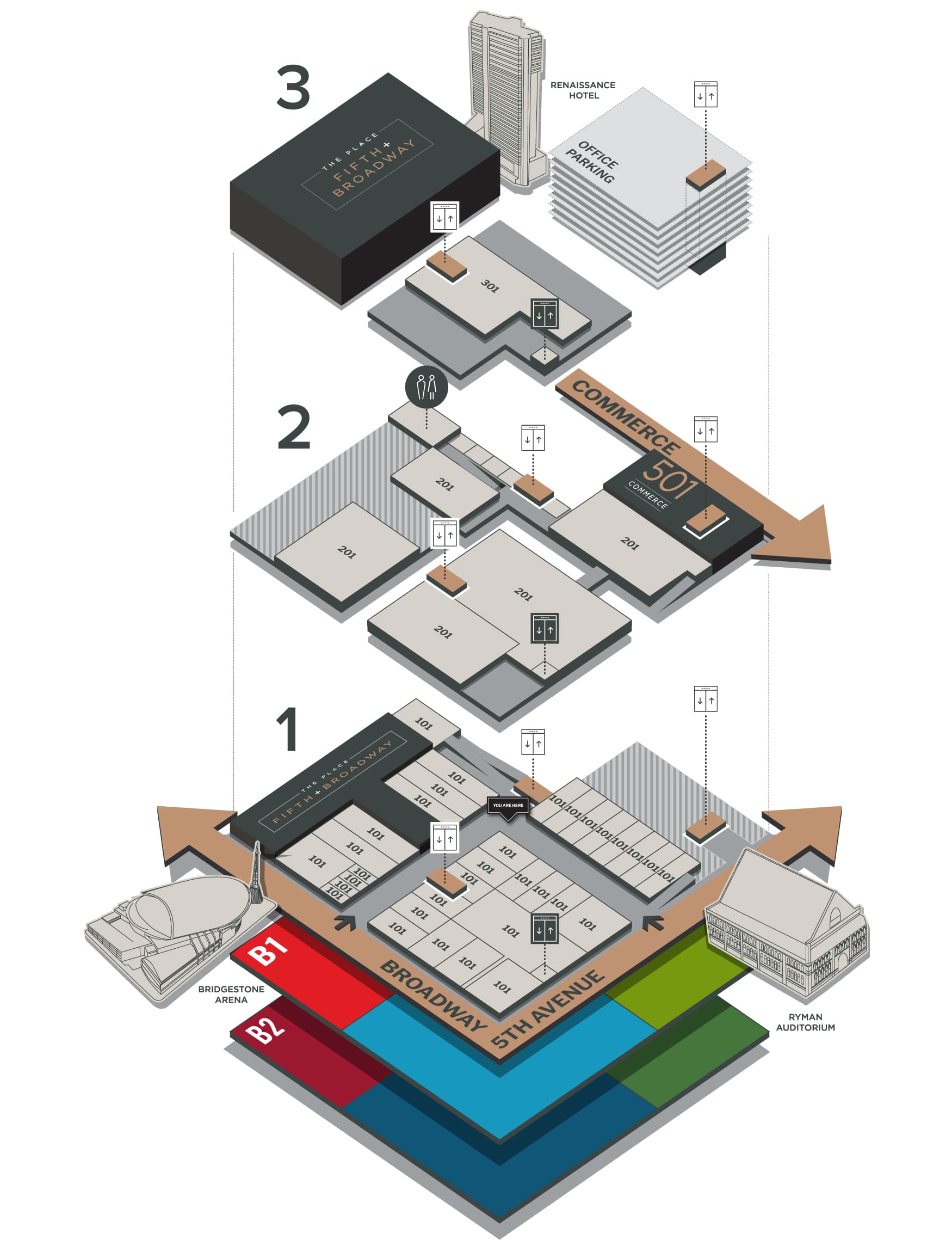
Our process of crafting a wayfinding design program starts with a careful flow analysis exploring how people move through places in your environment. Following this discovery phase, we design a visual kit of parts that carries the brand voice to match the user’s needs.
Our design process engages the user from varying perspectives to create a comprehensive wayfinding system that serves the community and evolves over time as your users’ needs change.
Take a look at our signage and wayfinding design projects below, or reach out to us today about working together.
Contact Us ›
Wayfinding Signage Design Projects
No project match your query. Try another search or set of filters.
Learn More About Wayfinding Design Strategies
The Wayfinding Profile
It’s much more than signage
All disciplines of design within the built environment must consider wayfinding as a key element of the user experience – planning, architecture, interiors, landscape, and lighting are all impacted by their relationship with wayfinding. Successful wayfinding design takes a multidimensional approach that includes all of the consultants working together with a common vision based on the principles of comfort and ease of navigation. By considering numerous experiential elements collectively, a comprehensive wayfinding strategy can create a seamlessly integrated and intuitive navigation experience for individuals within any environment.
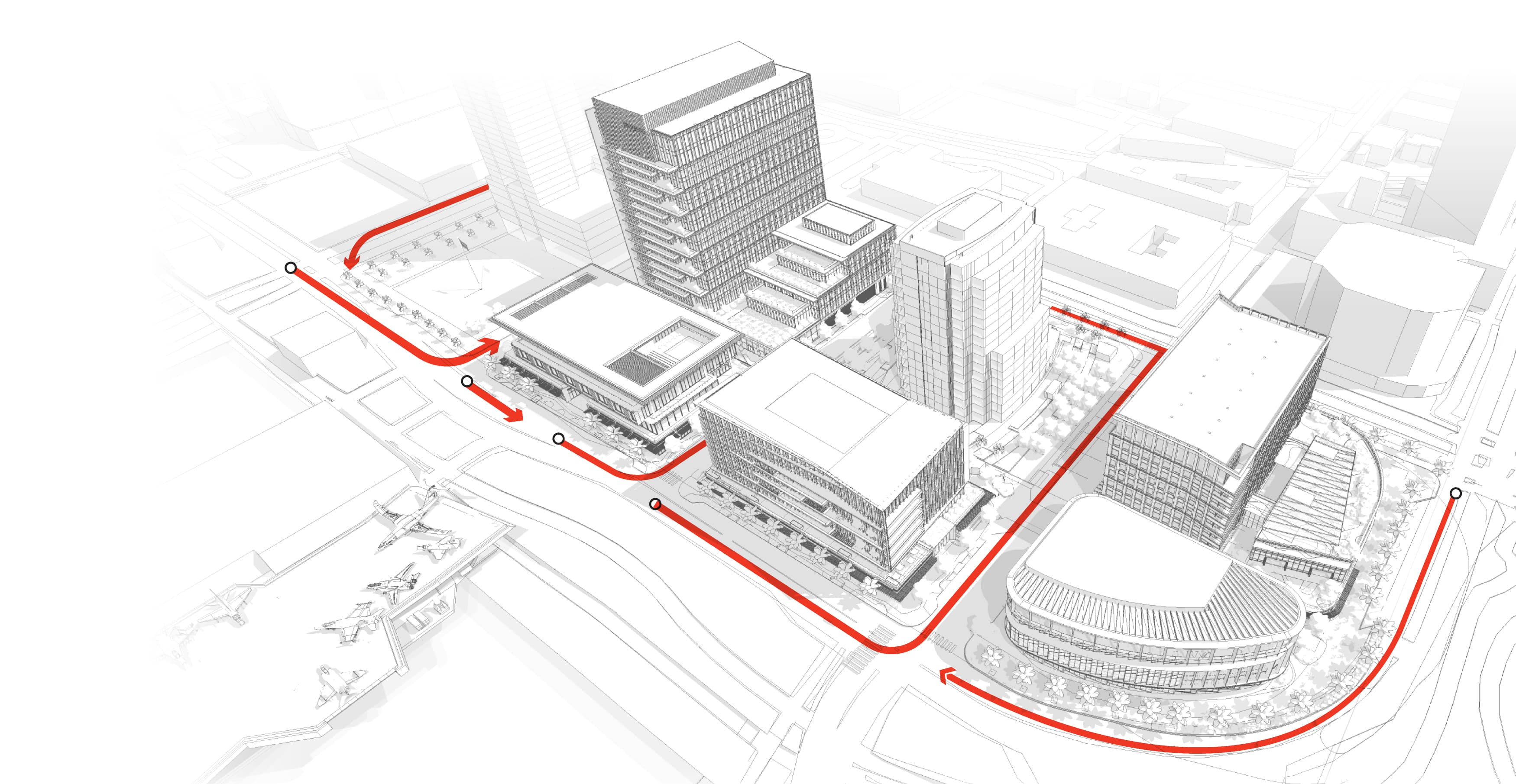
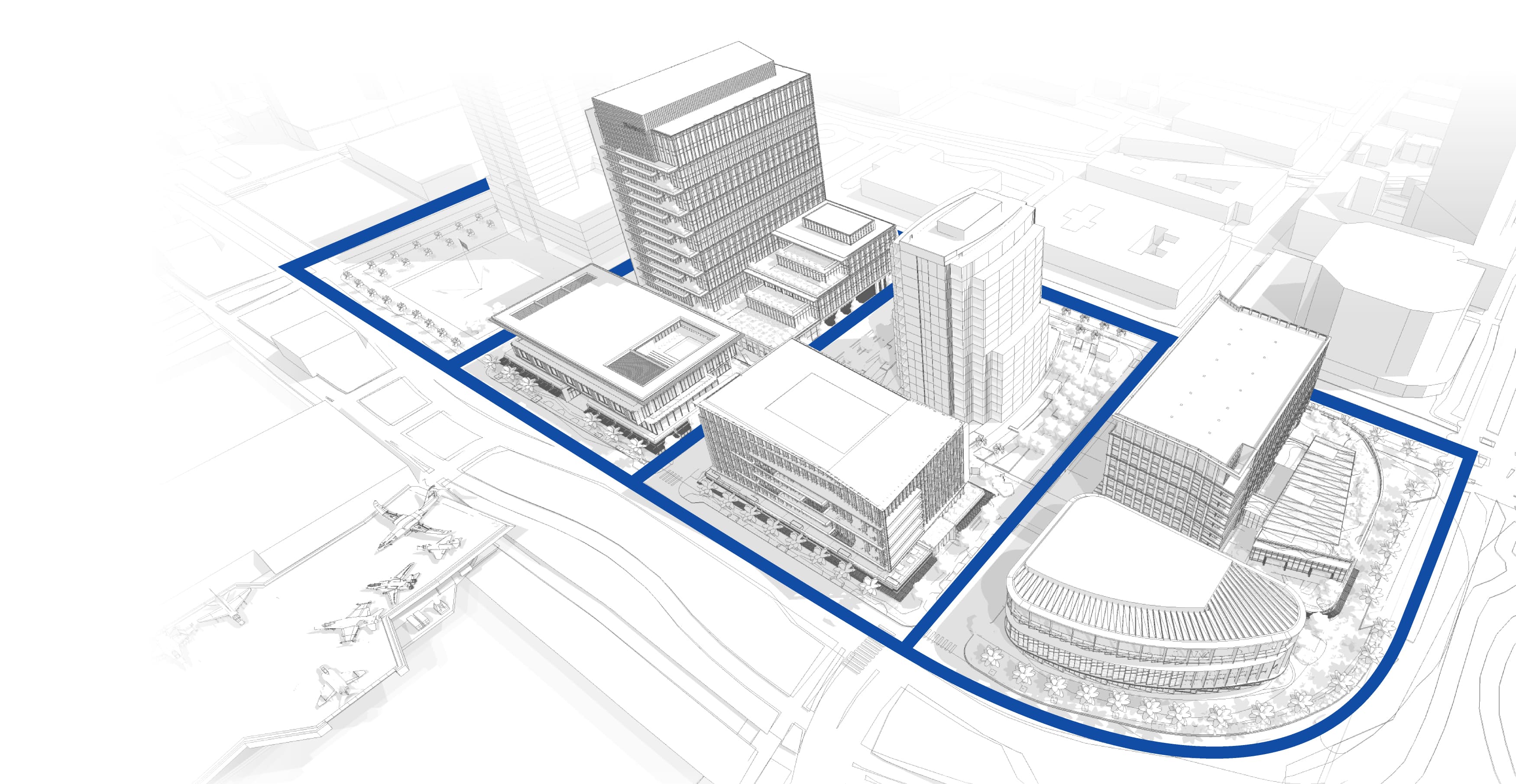
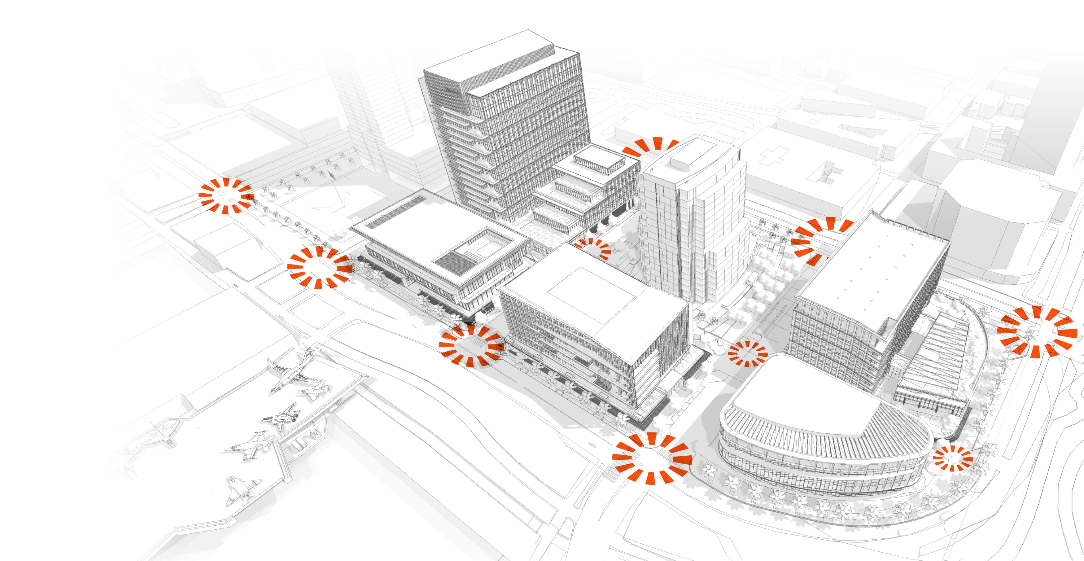
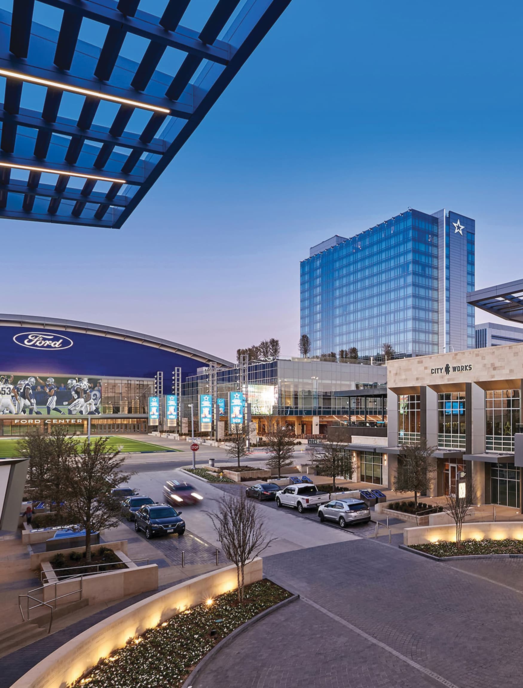
City Planning & Site Location
When a destination is located in close proximity to noteworthy landmarks, transportation hubs, or iconic attractions, it becomes easier for users to navigate successfully. This proximity allows for better spatial orientation and reduces the reliance on complex directions or extensive travel, enhancing the overall wayfinding experience.
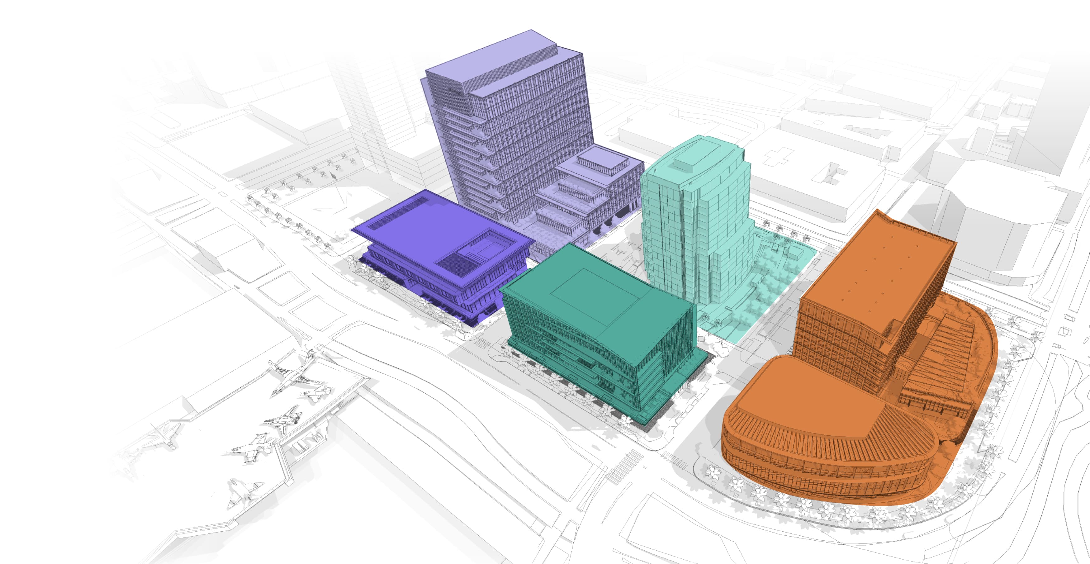
Architecture & Interiors
Architecture and interior design can impact wayfinding by providing clear layouts and visually distinct features that help individuals navigate and orient themselves within buildings. Considerations for accessibility and universal design further enhance the wayfinding experience, ensuring that everyone can easily navigate and orient themselves comfortably.
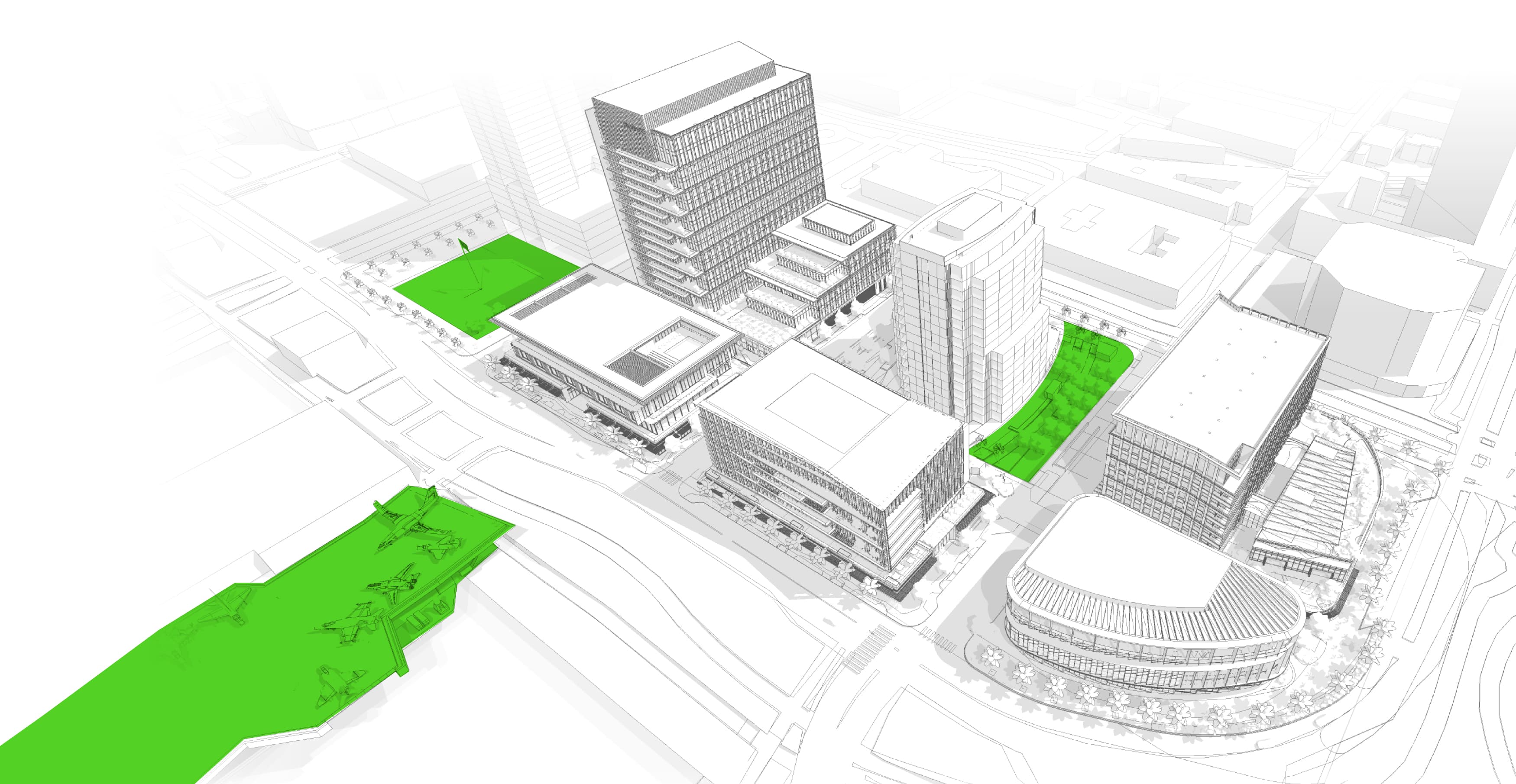
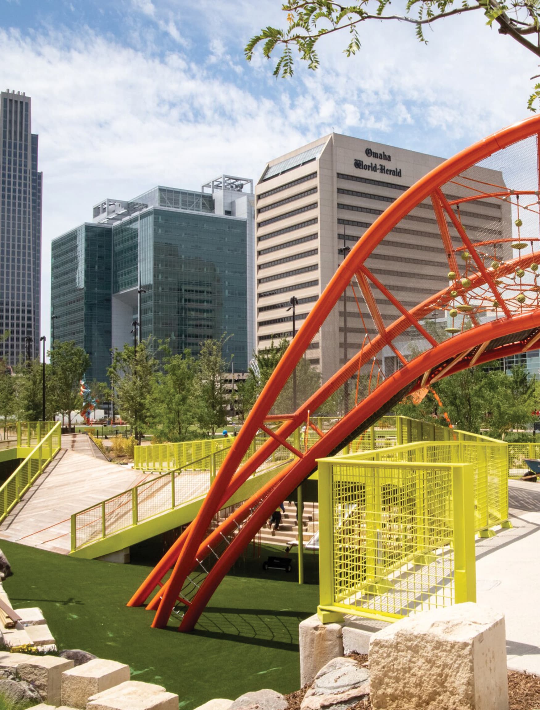
Landscape & Lighting
Landscape architecture and carefully curated lighting design can also play crucial roles in shaping wayfinding design. Well-designed thoughtful landscapes can provide assistance with orientation and navigation by featuring memorable elements. A properly planned lighting scheme enhances safety and visibility of the surroundings, making navigation much easier.
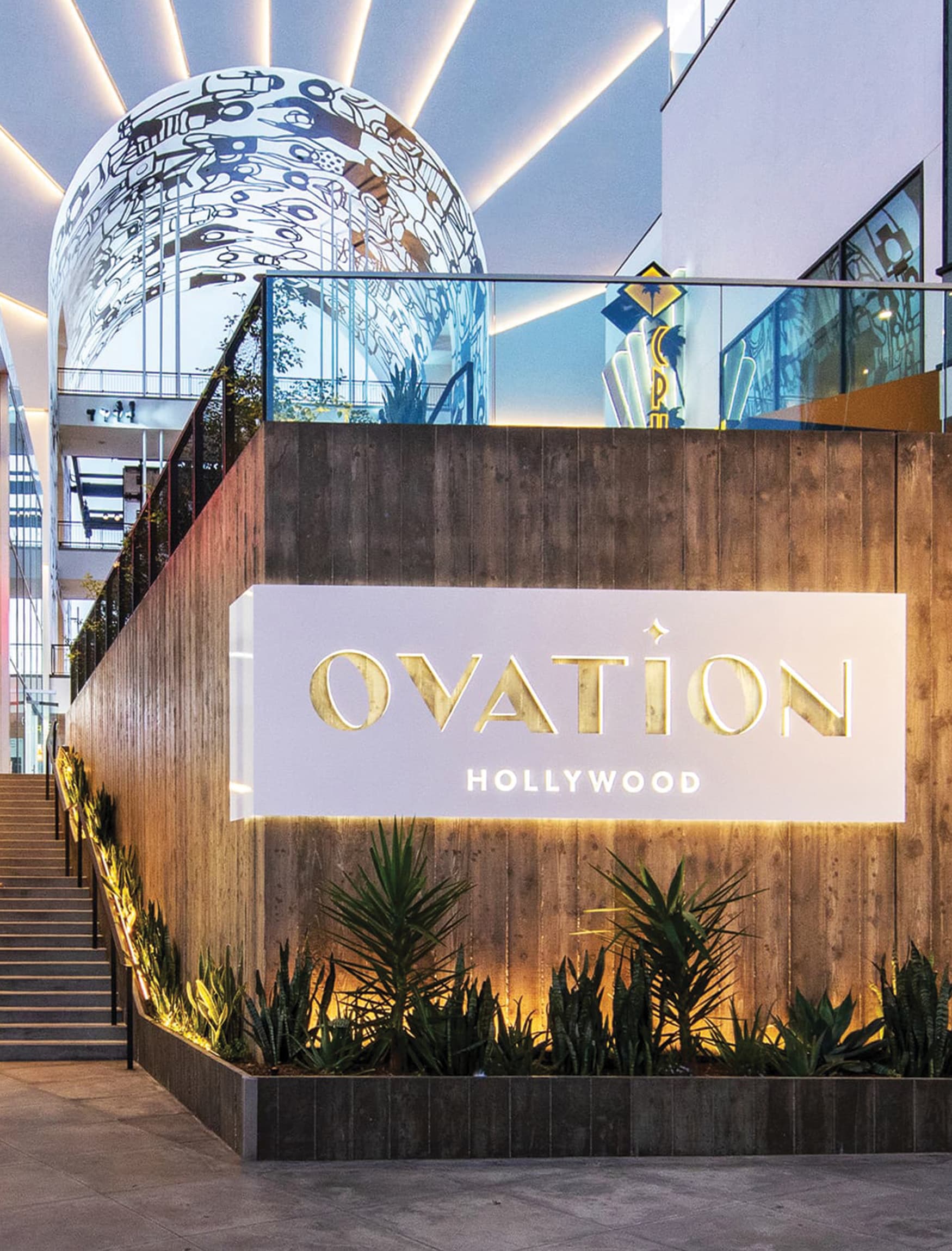
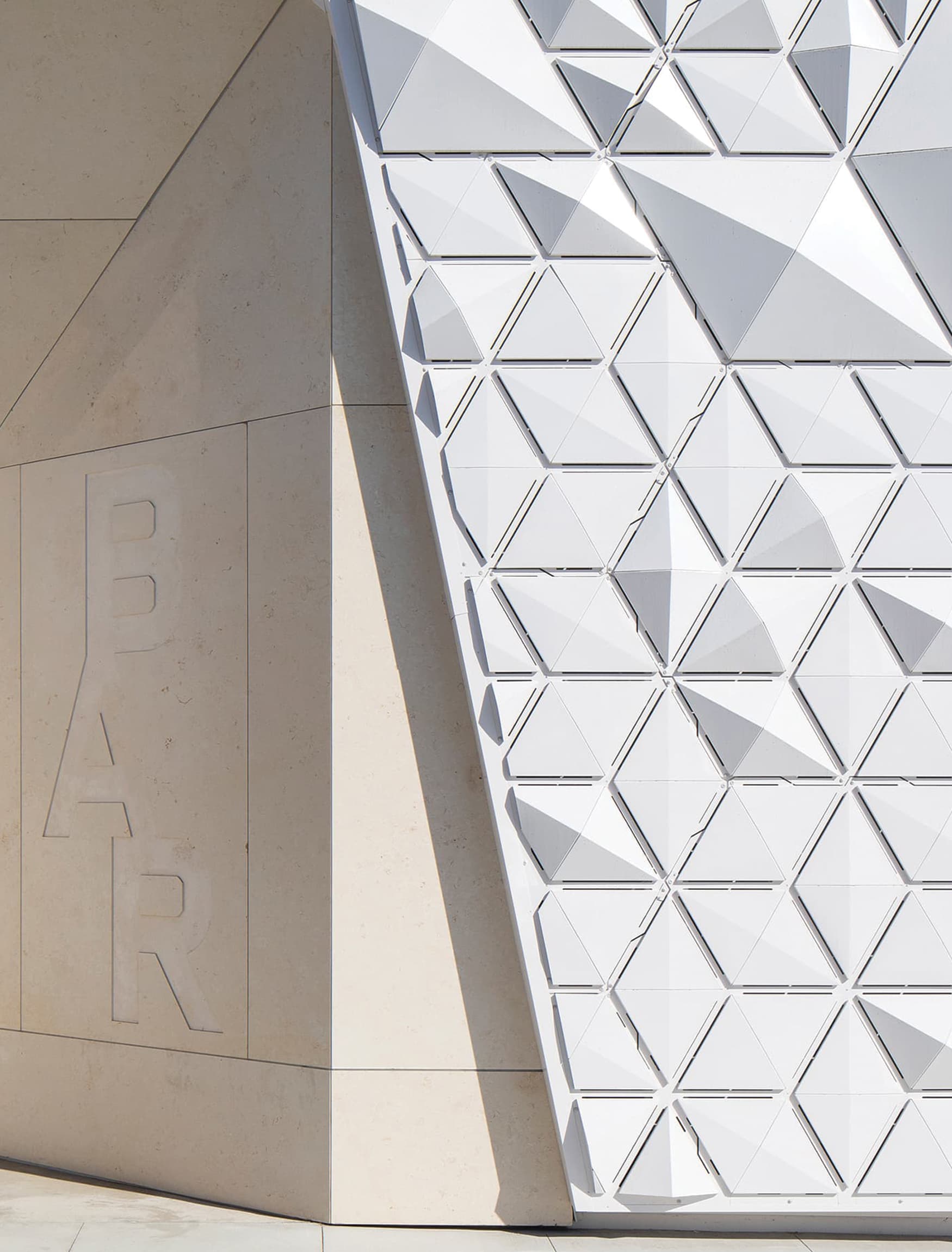
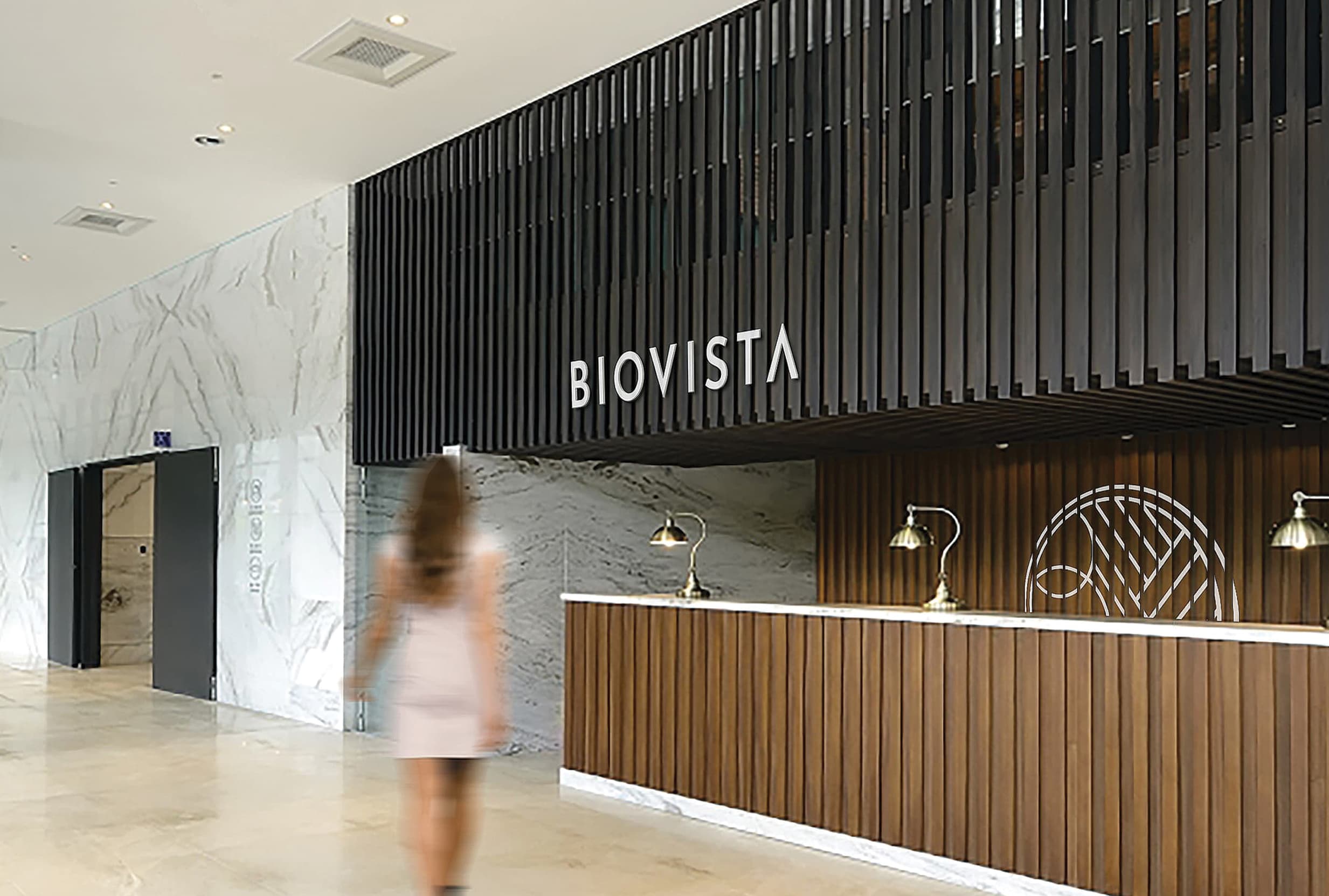
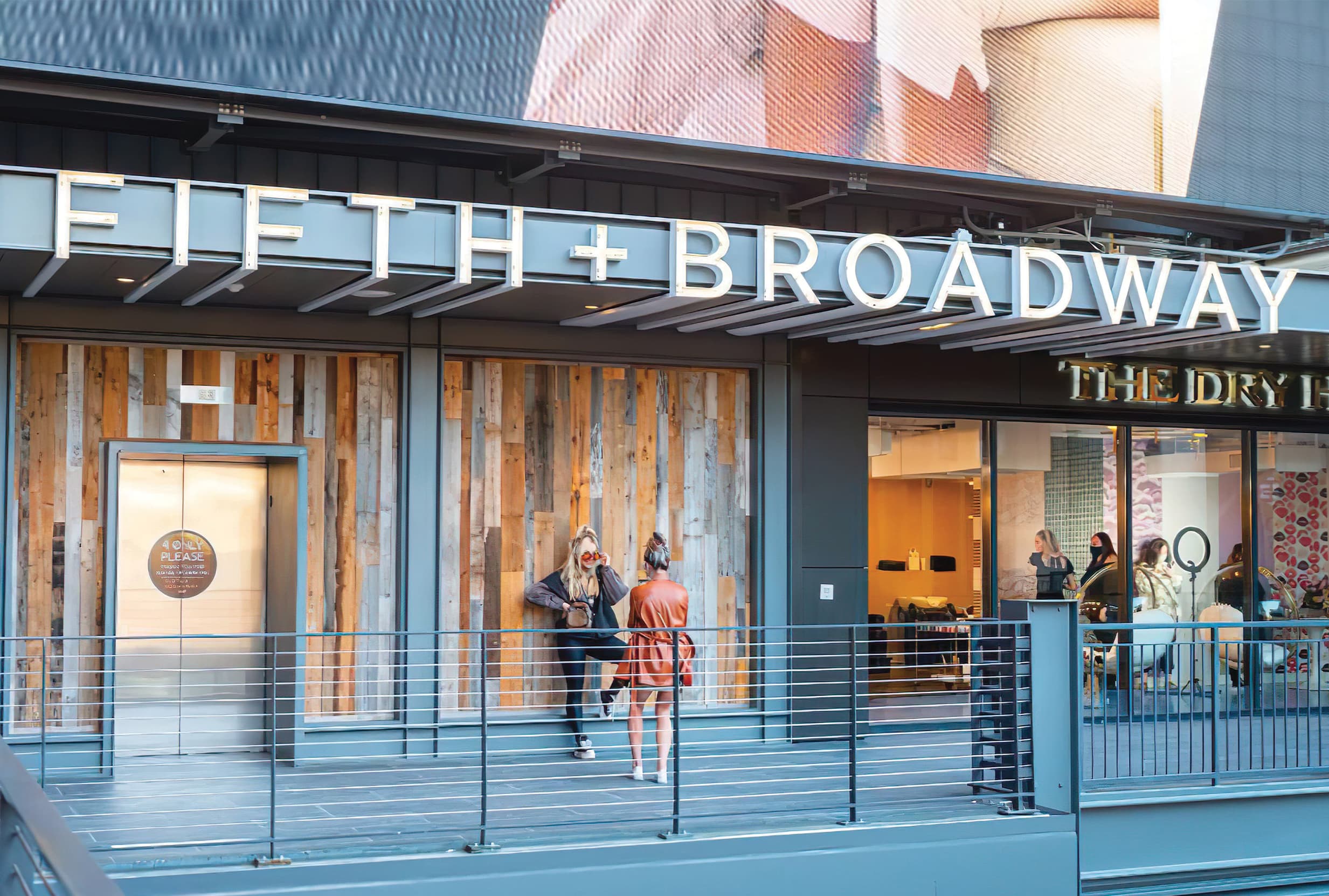
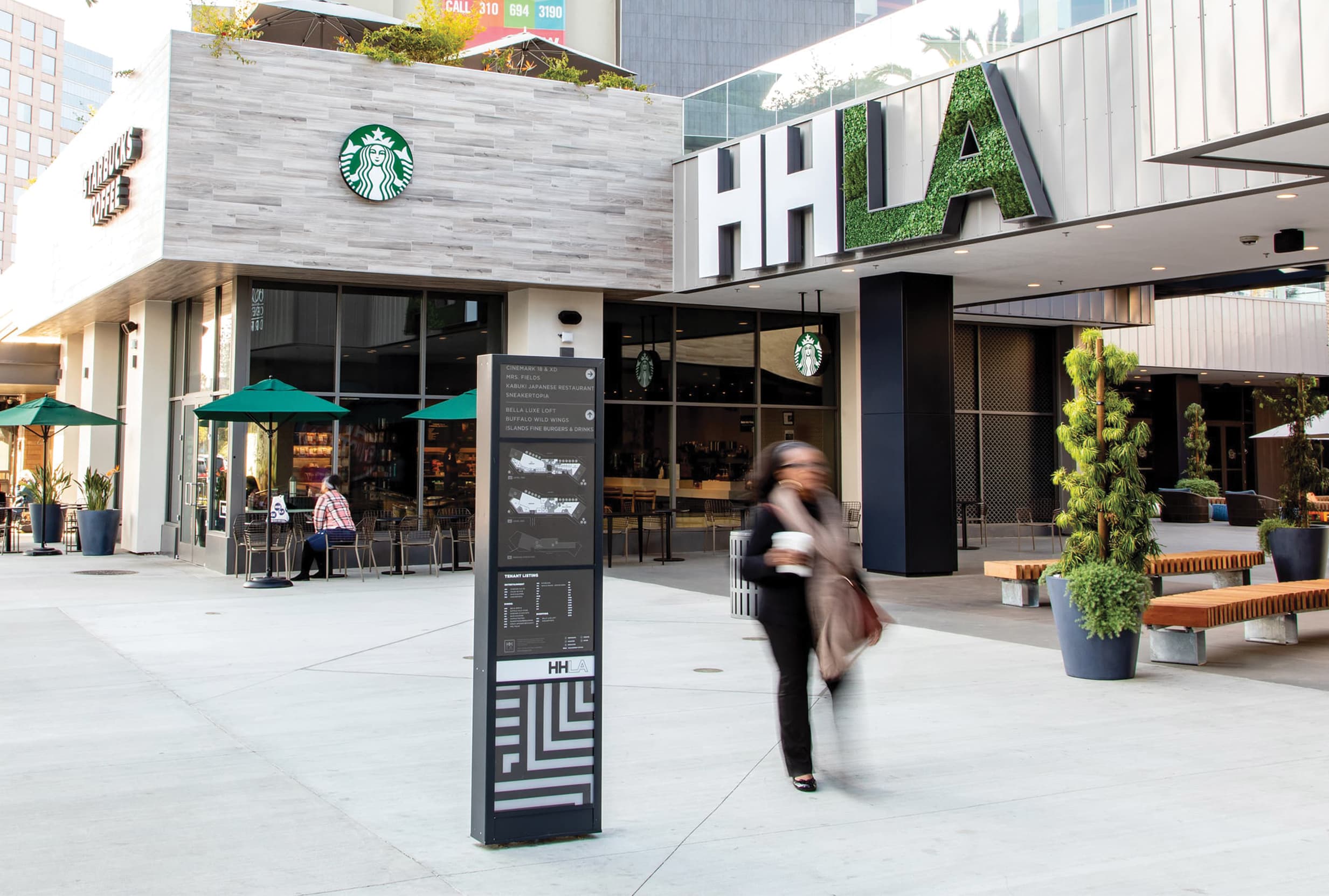
Wayfinding Graphics & Signage
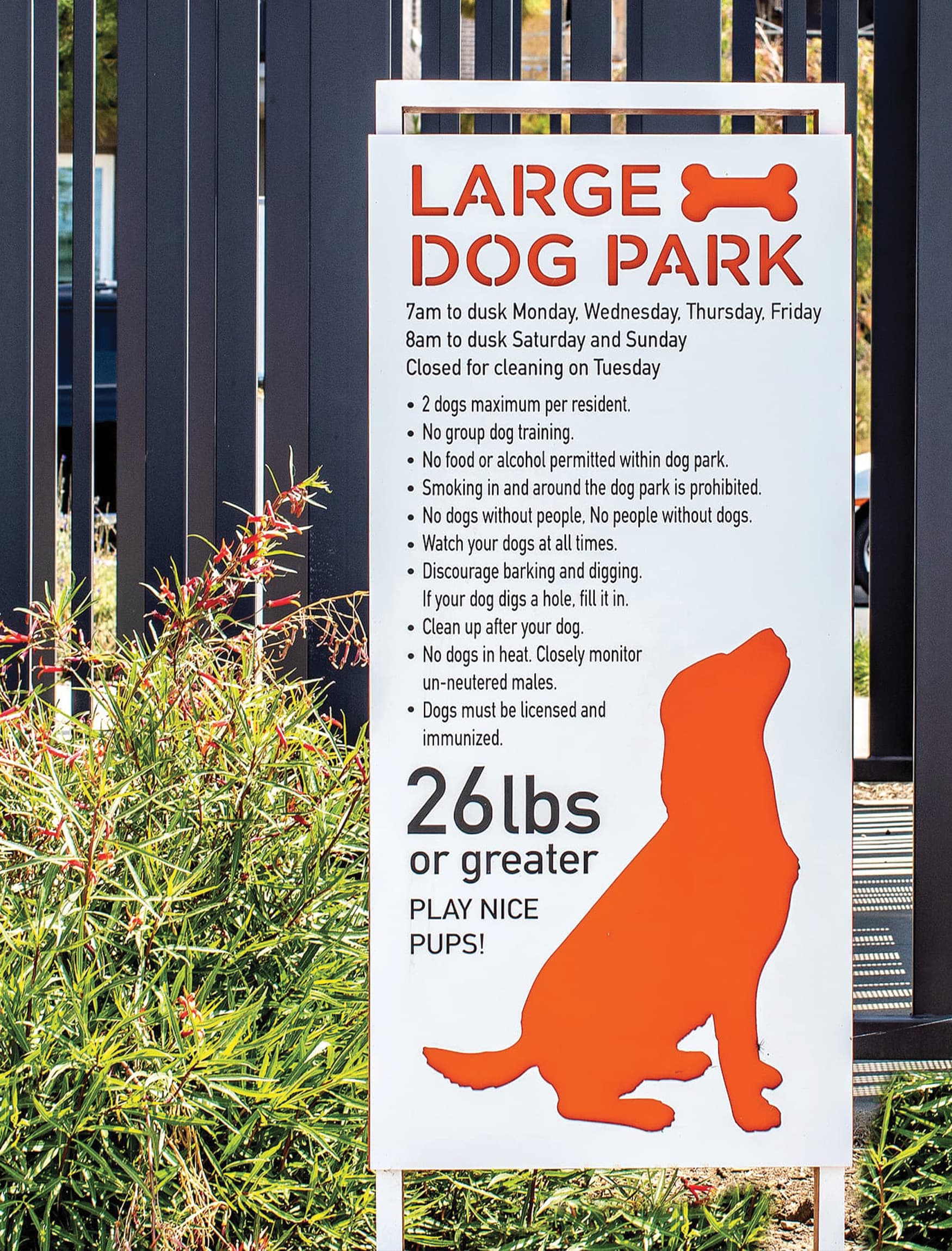
As a critical piece of the wayfinding profile, signage and graphics fill gaps left by other areas of the built environment. Well-designed and strategically placed signage enhances navigation and improves the overall wayfinding experience by providing clear directions, identifying destinations, and conveying important information in a branded visual manner. Importantly, if the environment decodes itself, then there is less need for traditional wayfinding signage. The goal is not more wayfinding signage, but better collective wayfinding elements.
Needs of the Built Environment
Human needs translated for the built environment
In Abraham Maslow’s 1943 book A Theory of Human Motivation, he outlines a number of needs that build on each other….physiological needs, food, water, warmth, rest, safety, love and belonging, esteem, and self-actualization. These can be reinterpreted for the built environment in the form of “Certainty, Variety, and Delight.” These three key human needs are a guide to developing a suite of elements that people are drawn to instinctively because they satisfy basic human needs that are desired subconsciously.

Certainty
Maps, Arrows, Labels, Symbols
Certainty deciphers the environment for the user and primarily identifies uses, assists with navigation, and directs traffic. One can let their guard down with the understanding of the environment, and these elements of certainty provide assurance and comfort. All aspects of the wayfinding profile assist in creating certainty for the user.

Variety
Scale, Color, Pattern, Form
Variety keeps things interesting while providing a functional breakdown of the overall experience into smaller, more intimate experiences. These varying areas denoted by differing elements carry the same DNA origins, but help with the user’s cognitive mapping of an environment.

Delight
Sculpture, Art, Whimsy, Surprise
Delight is the fun part—it’s the colorful sculpture or mural or unexpected feature where people want to engage and experience on an emotional level. These landmark moments add to the wayfinding experience in subtle, intuitive ways and typically inform the personality of the place through interpretation of various influences such as culture, community, history, and emotion.
“Structuring and identifying the environment is a vital ability among all mobile animals.” —Kevin Lynch
Where did the term wayfinding come from?
One can’t discuss wayfinding within the built environment without mentioning Kevin Lynch and The Image of the City where he shared that a city or space can be “classified into five types of elements: paths, edges, districts, nodes, and landmarks.” These elements acting at multiple scales facilitate clear movement throughout a place for vehicles and pedestrians. Wayfinding, which is truly everywhere in the built environment, becomes a critical component of navigation.
More on Kevin Lynch in our article: What is Wayfinding? ›
Paths
“The channels along which the observer customarily, occasionally, or potentially moves. They may be streets, walkways, transit lines, canals, railroads.” These channels provide the framework for wayfinding design as they directly facilitate movement and connections.
Edges
Districts
Nodes
Landmarks
What are the different types of Wayfinding?
Components of Wayfinding
Identities
Helping individuals identify and locate specific sites, buildings, or rooms, these elements typically display names, numbers, or labels that allow for easy recognition and identification of desired destinations.
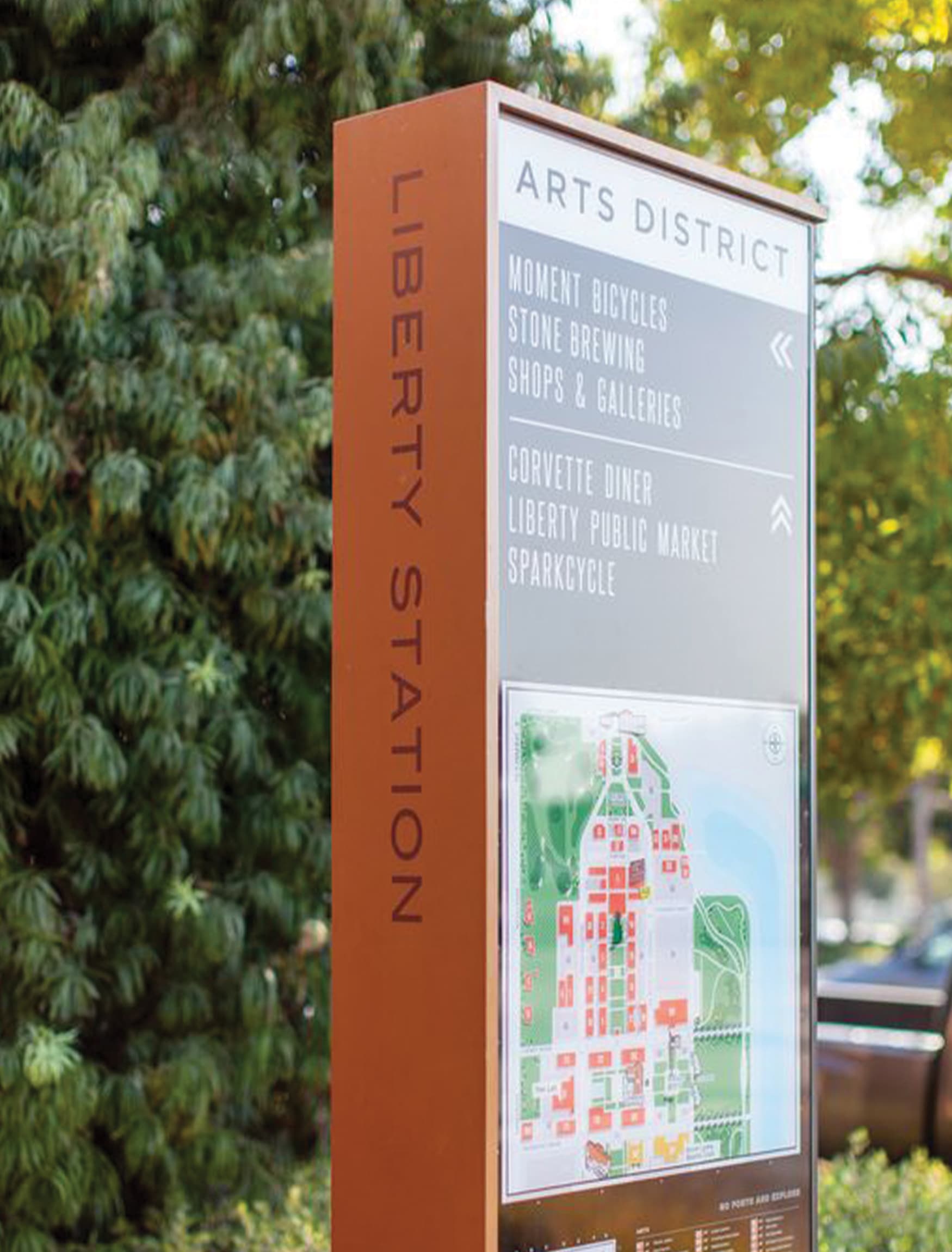
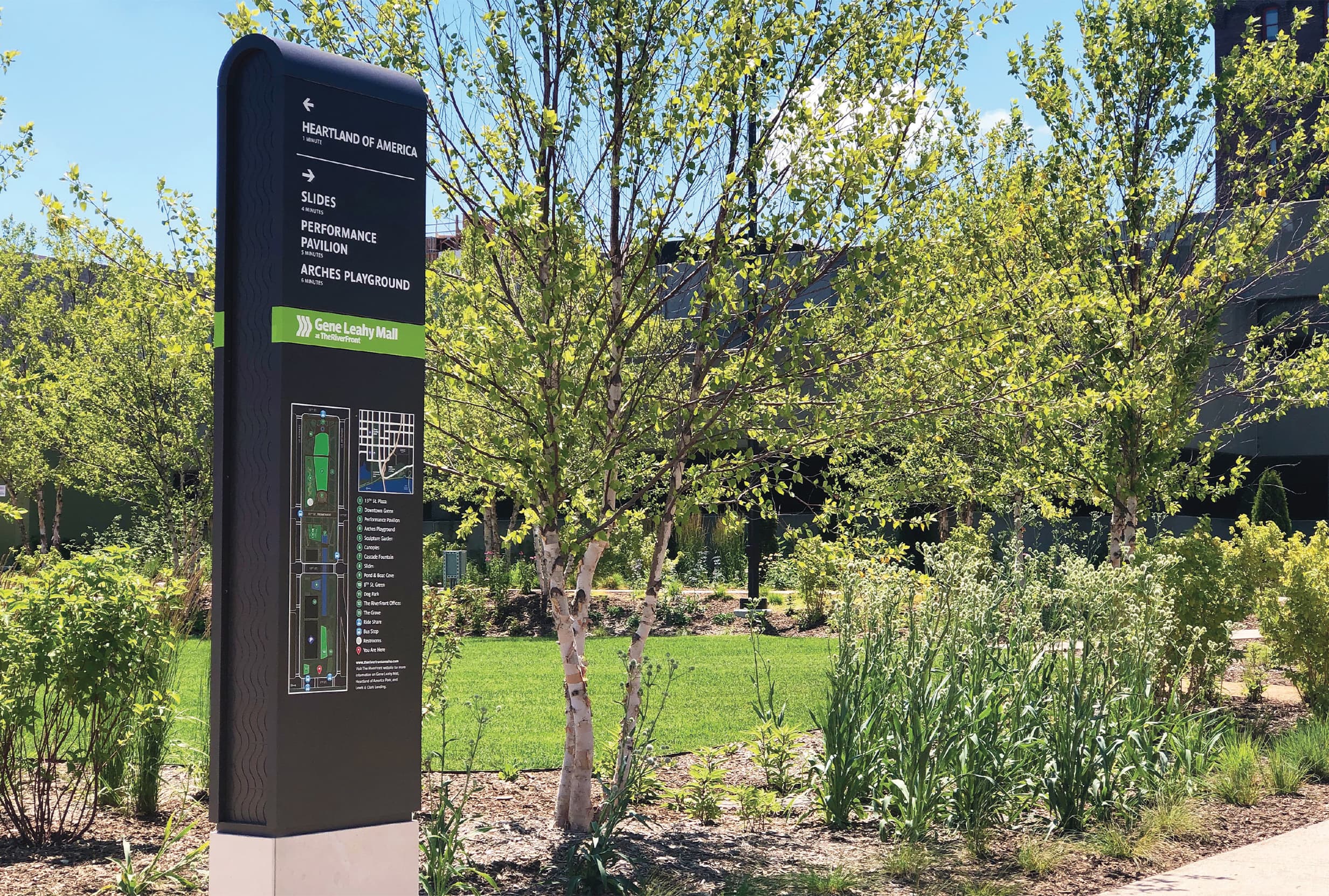
Information
General information about the surroundings, landmarks, or points of interest help users understand their context, location, or culture and make informed decisions about their route, learning, and discovering along the way.
Regulatory
Rules, regulations, or restrictions that individuals must follow in a particular area are important tools to provide information such as speed limits, parking restrictions, or specific instructions for accessing certain areas.
Lighting Design
The transition of wayfinding from day to night needs to be seamless. The way feature lighting elements can highlight a path, landmark, or decision making point can be critical to the success of the holistic guest experience.
Landscape Design
In concert with architecture and signage, the way softscape and hardscape are treated can aid in the wayfinding experience by creating memorable and tactile landmarks in the spaces between buildings.
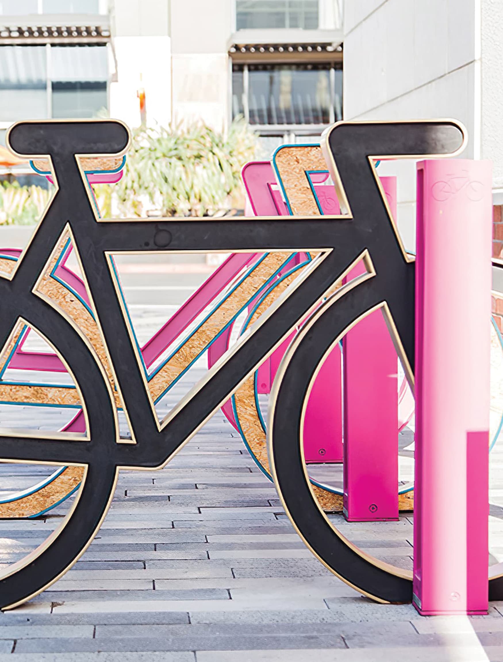
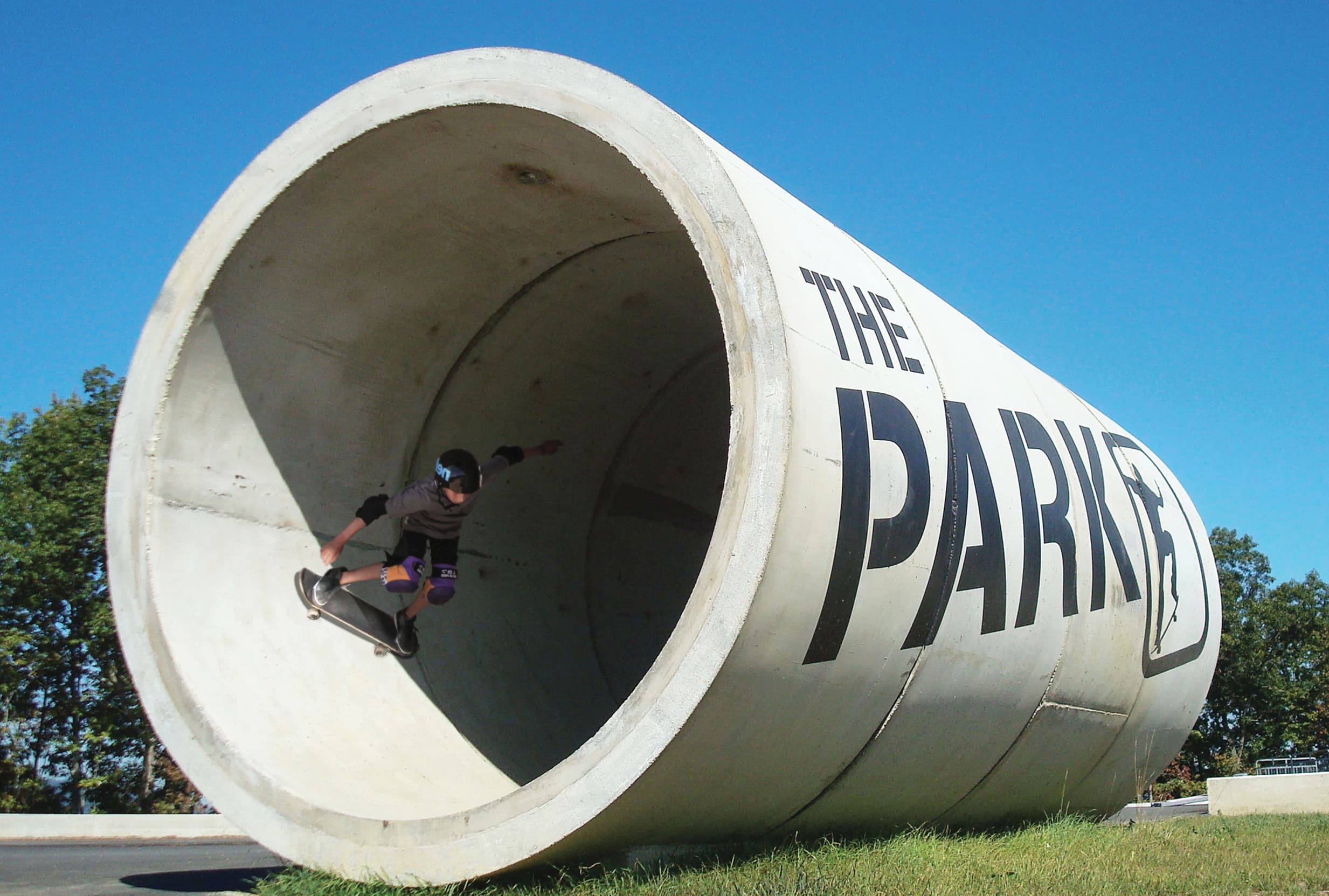
Art & Sculpture
Wayfinding tools do not only include traditional forms of signage, but also properly placed art and other engaging elements. These create visual and intuitive clues to aid in comfortable navigation—and have some creativity and enjoyment along the way.
Architectural Features
Collaboration with the architecture can provide intuitive, integrated features that are equally as important to clear navigation as a sign and are seamlessly woven into the user experience. For example, “Take a left at the big, red wall.”
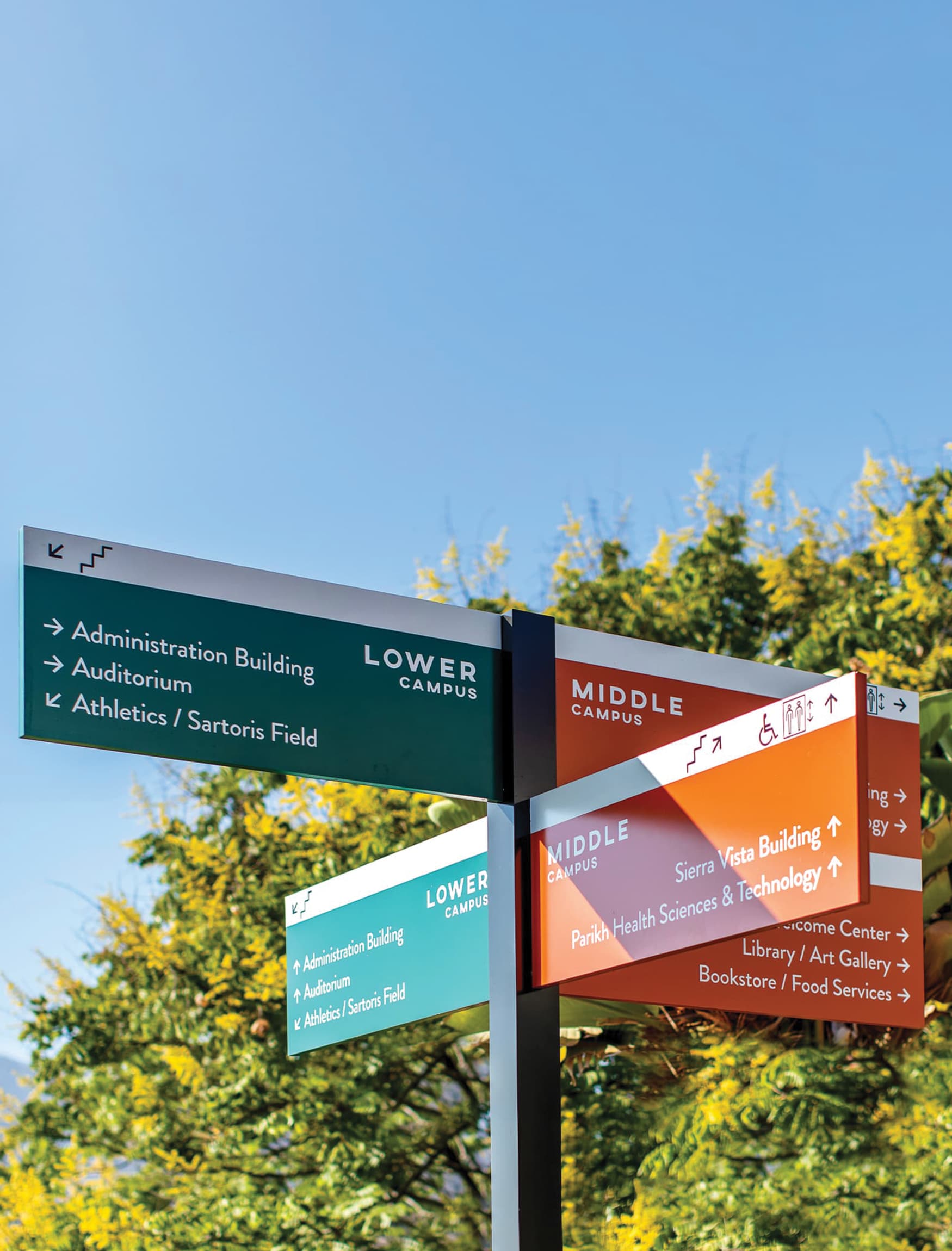
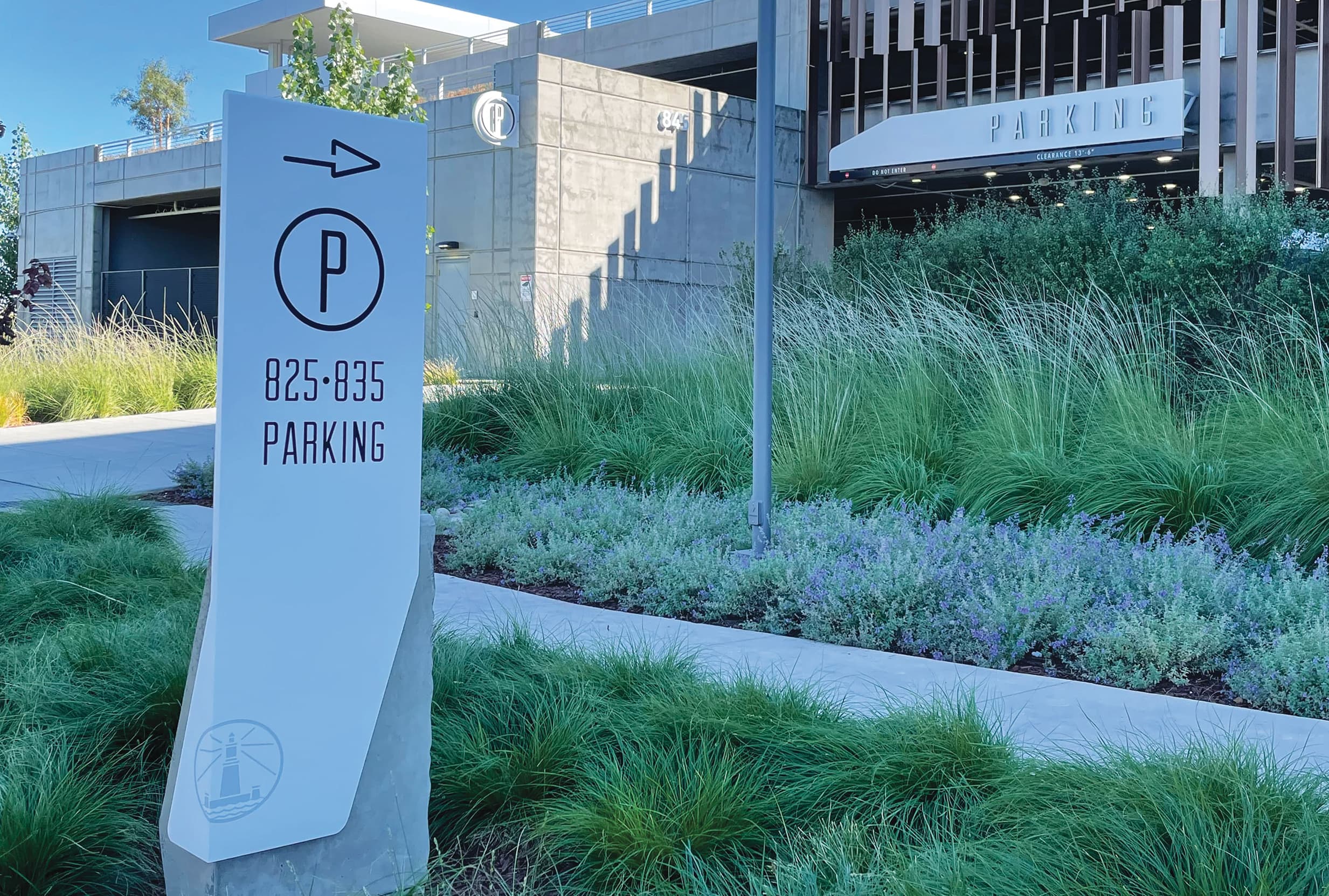
Directionals
Providing specific instructions and pointing the user towards different destinations, these wayfinding components ease navigation and indicate paths to follow and discover.
Topic Series
Articles on Wayfinding Design
What is Wayfinding?
›What is Next in Wayfinding?
›Three Voices: Conversations on Wayfinding
›


Wayfinding Signage Markets
RSM Design specializes in creating intuitive wayfinding sign design and solutions for a diverse range of markets, including hospitality, healthcare, mixed-use, residential, and corporate. Essentially any private or public place is within our domain. Leveraging our expertise in developing wayfinding systems, we transform spaces into accessible, engaging, and memorable destinations tailored to each project's unique needs and identity.
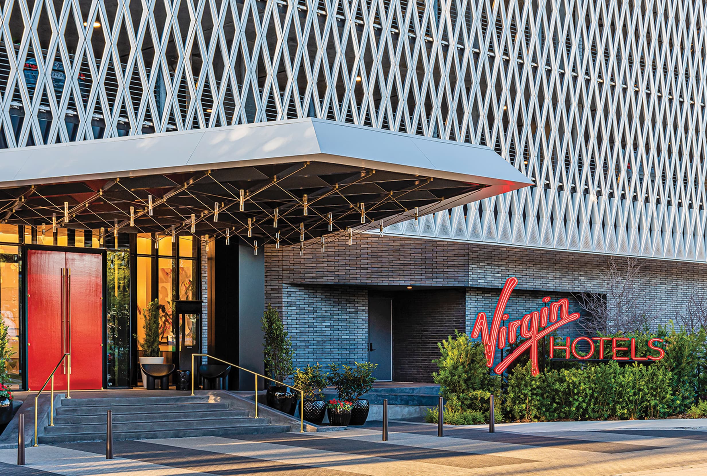
Hospitality Wayfinding Signage
Wayfinding signage design tailored to the needs of hotels, resorts, and the hospitality sector.
View Page ›
Health & Wellness
Starting with meticulous research, we plan and strategize for the wayfinding signage design needs of each hospital, medical center, or clinic.
View Page ›
Mixed-Use Wayfinding
Adaptable wayfinding signage design systems that suit the variety of needs at mixed-use developments.
View Page ›
Sports & Entertainment
Wayfinding signage design for sports-focused venues and entertainment districts.
View Page ›
Cultural Wayfinding
Well-designed wayfinding design systems add value to one’s experience within cultural centers, galleries, and museums.
View Page ›
Retail Wayfinding Signage
Wayfinding signage elevates the guest experience, resulting in a holistic shopping and entertainment project.
View Page ›
Science & Technology
With our extensive experience, we seek to enhance scientific workplaces and spaces so discovery can flourish.
View Page ›
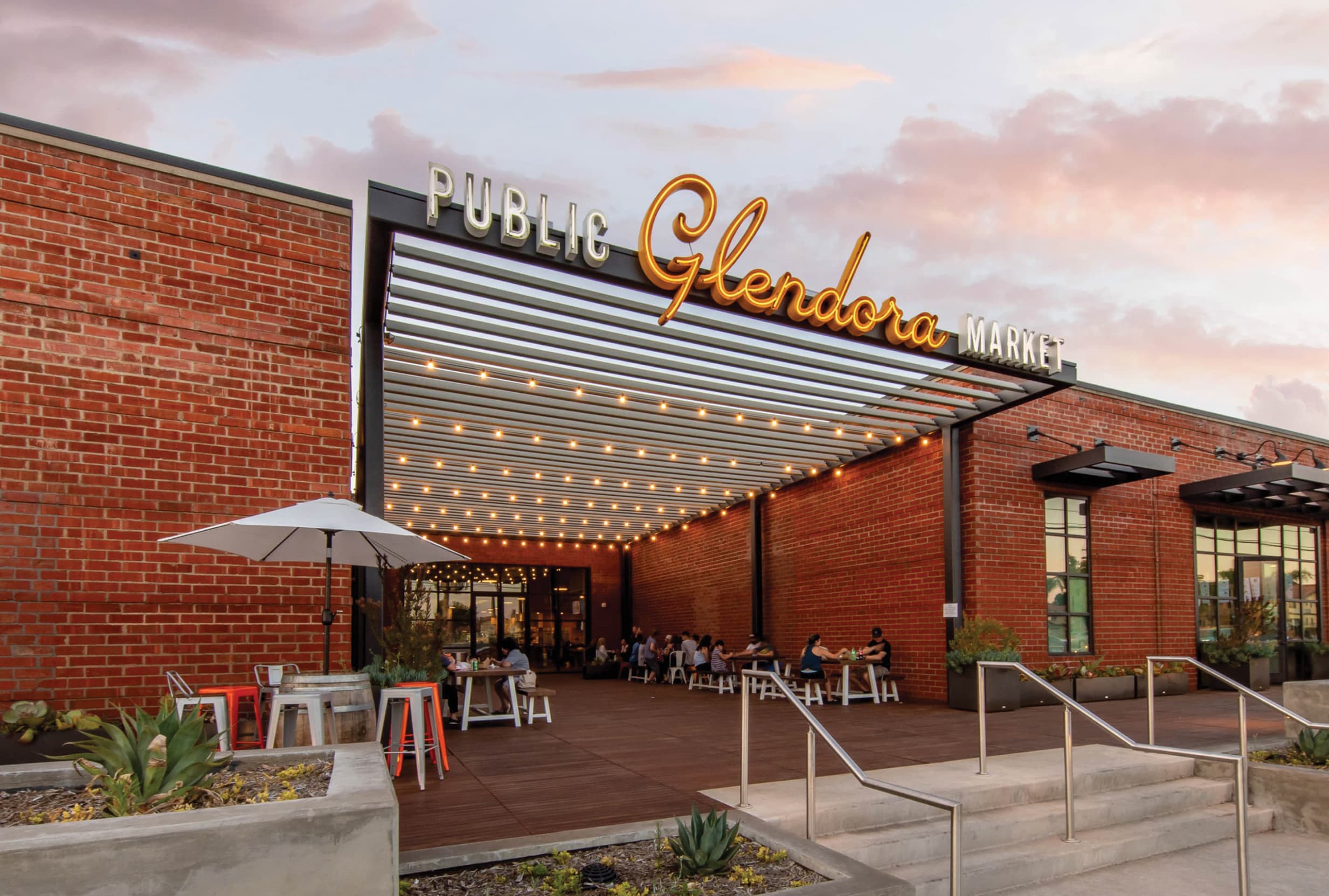
Food & Beverage
Creating eclectic wayfinding signage and graphics programs for food halls, public markets, restaurants, and cafes.
View Page ›
Park Wayfinding Signage
Working closely with cities, communities, and developers to connect people with outdoor spaces through creative park wayfinding signage.
View Page ›
Civic Wayfinding Design
Comprehensive wayfinding signage solutions tailored to civic environments where the goal is to facilitate efficient navigation and enhance public accessibility and engagement.
View Page ›
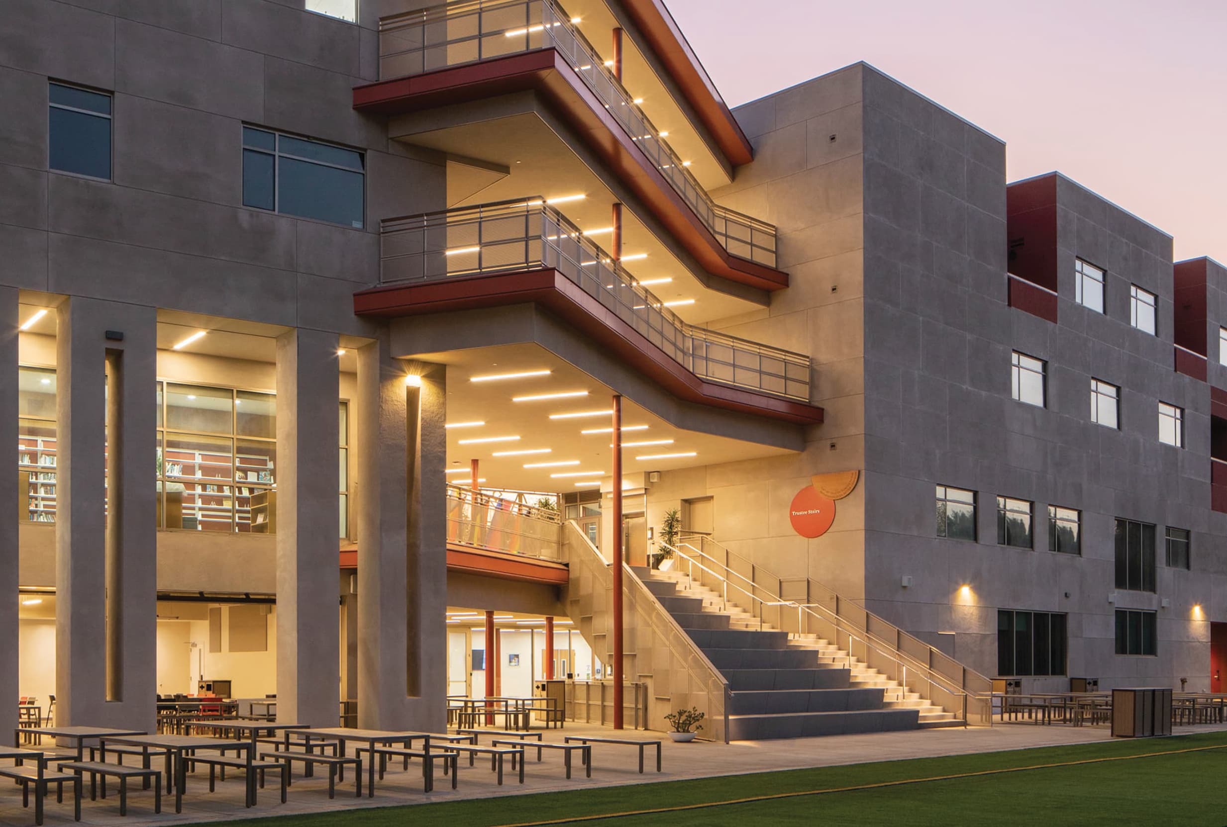
Education Wayfinding Signage
Seamless navigation and enhanced campus accessibility for students, faculty, and visitors through integrated wayfinding design.
View Page ›
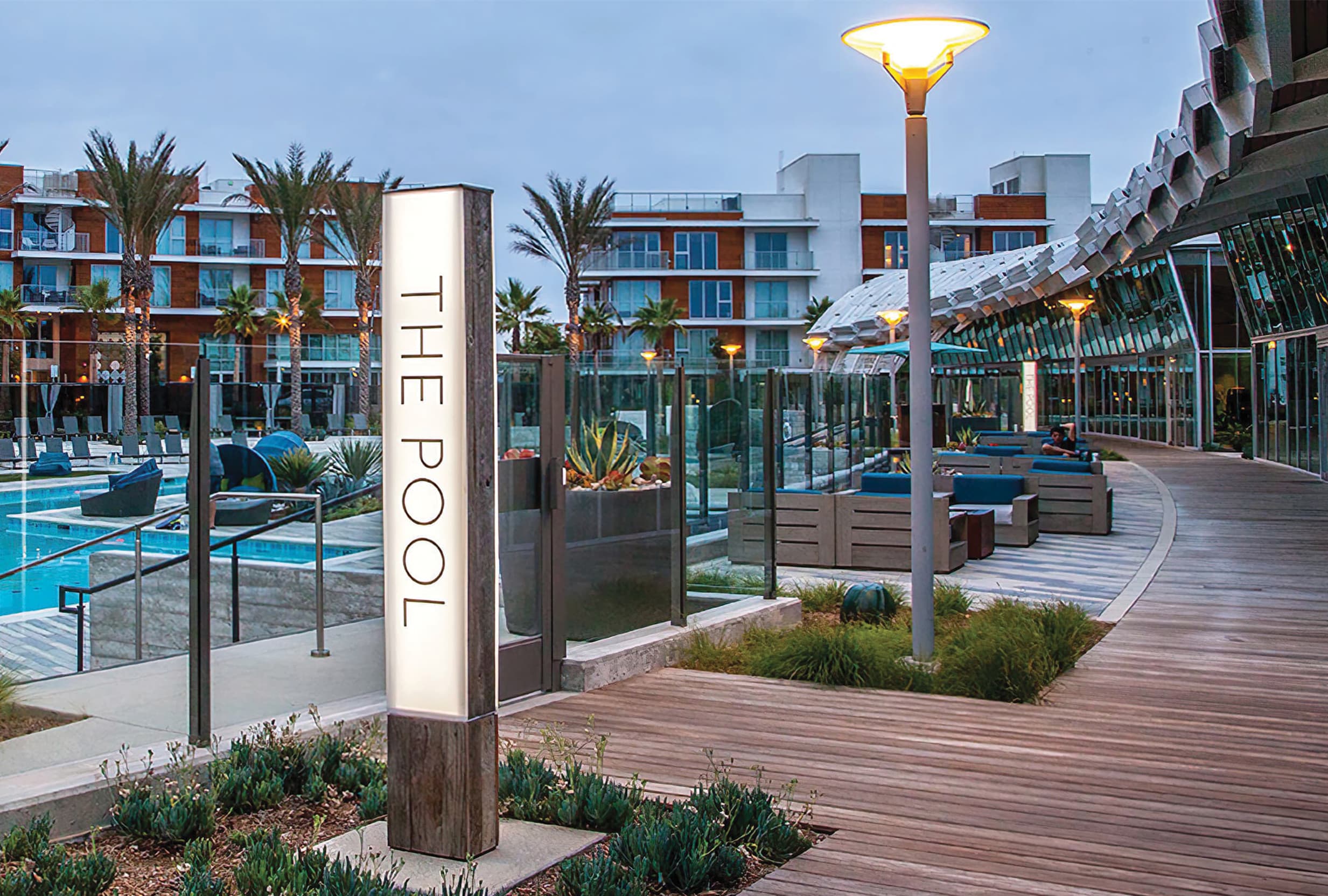
Residential Community Design
Convenient navigation and elevated living experience for residents within neighborhoods and communities.
View Page ›
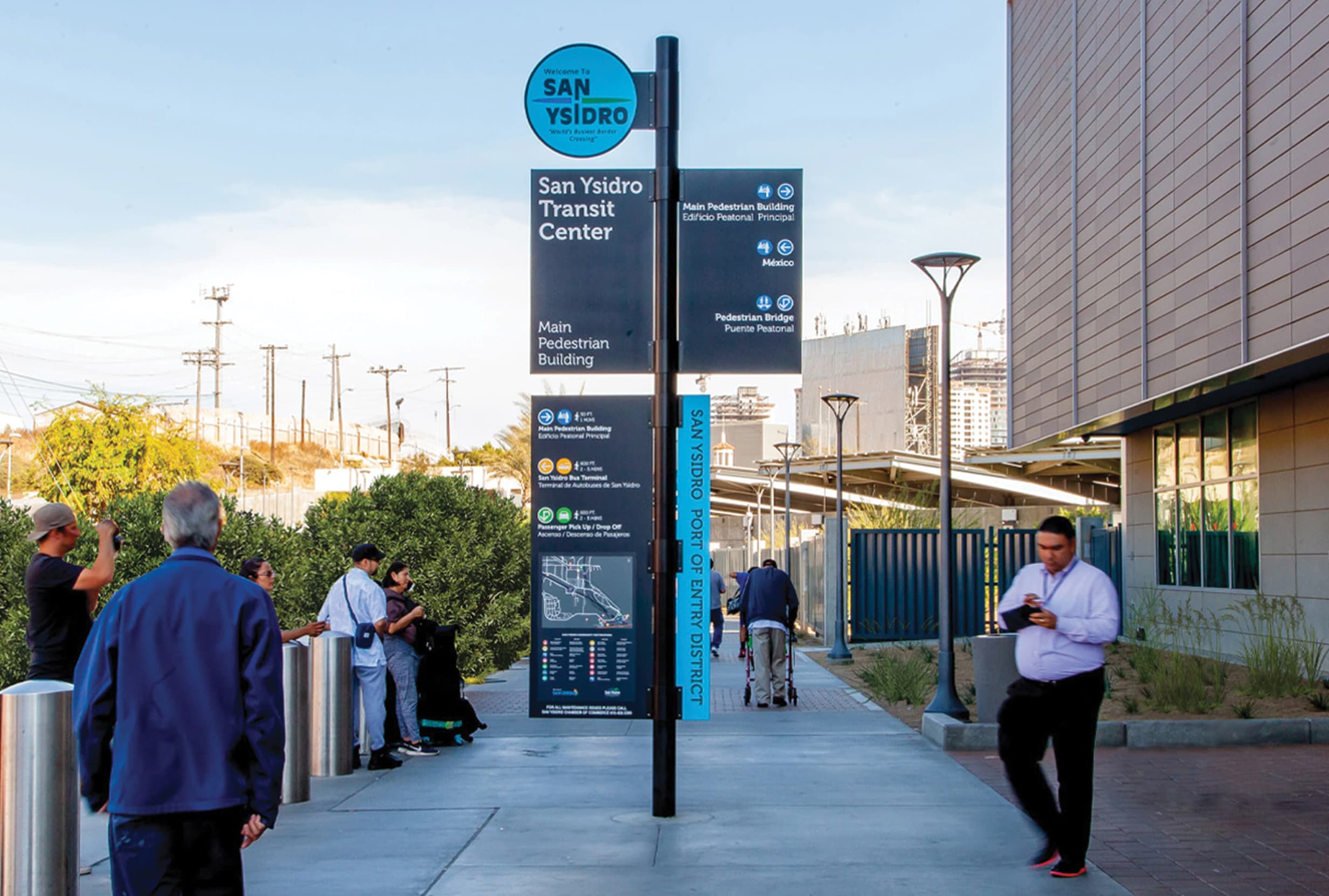
Transit Wayfinding Signage
Streamlining navigation and enhancing passenger experiences across various modes of transportation.
View Page ›
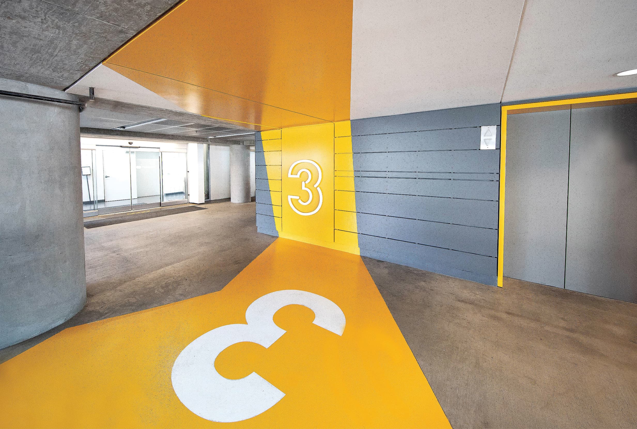
Parking Garage Wayfinding
Optimized navigation and efficient vehicle flow within the arrival experience of parking garages.
View Page ›
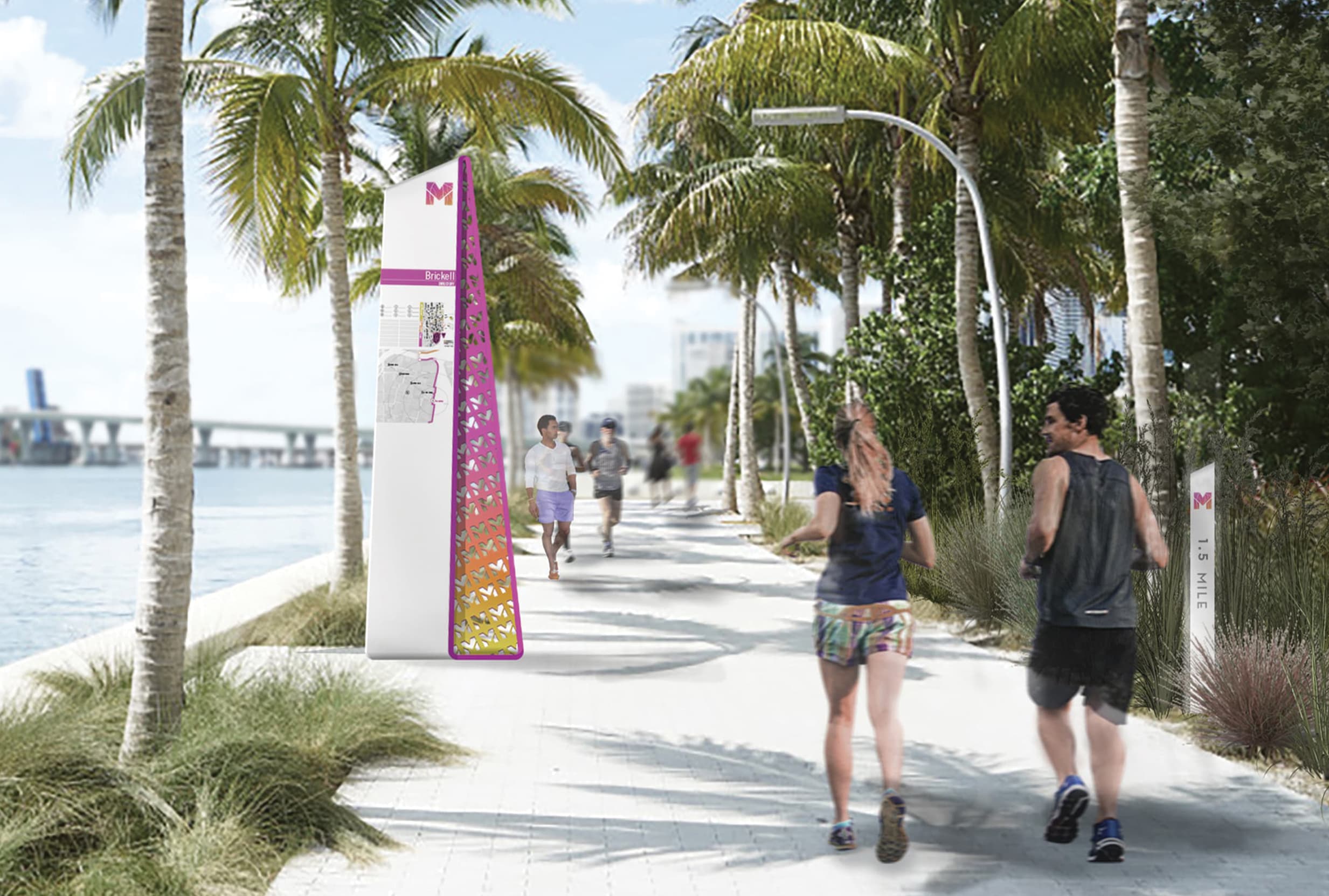
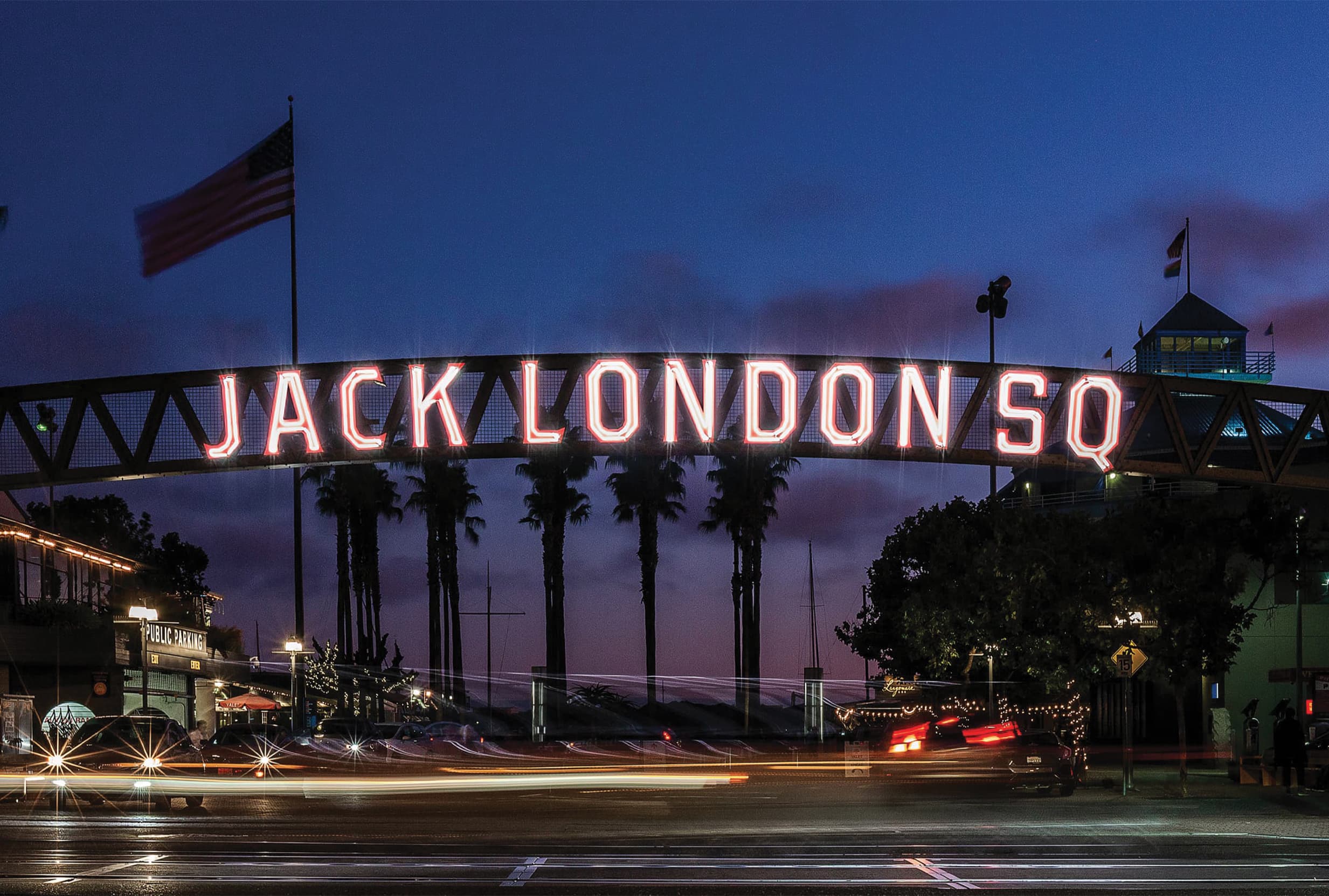
Waterfront Wayfinding Signage
Facilitating easy navigation and enhancing visitor experiences along the waterfront promenade.
View Page ›
Get in Touch
Contact Us ›
RSM Design focuses on research-driven design to create comprehensive and timeless wayfinding systems that enhance the user’s experience and serve the greater good of the community.