San Diego, California
San Ysidro Port of Entry
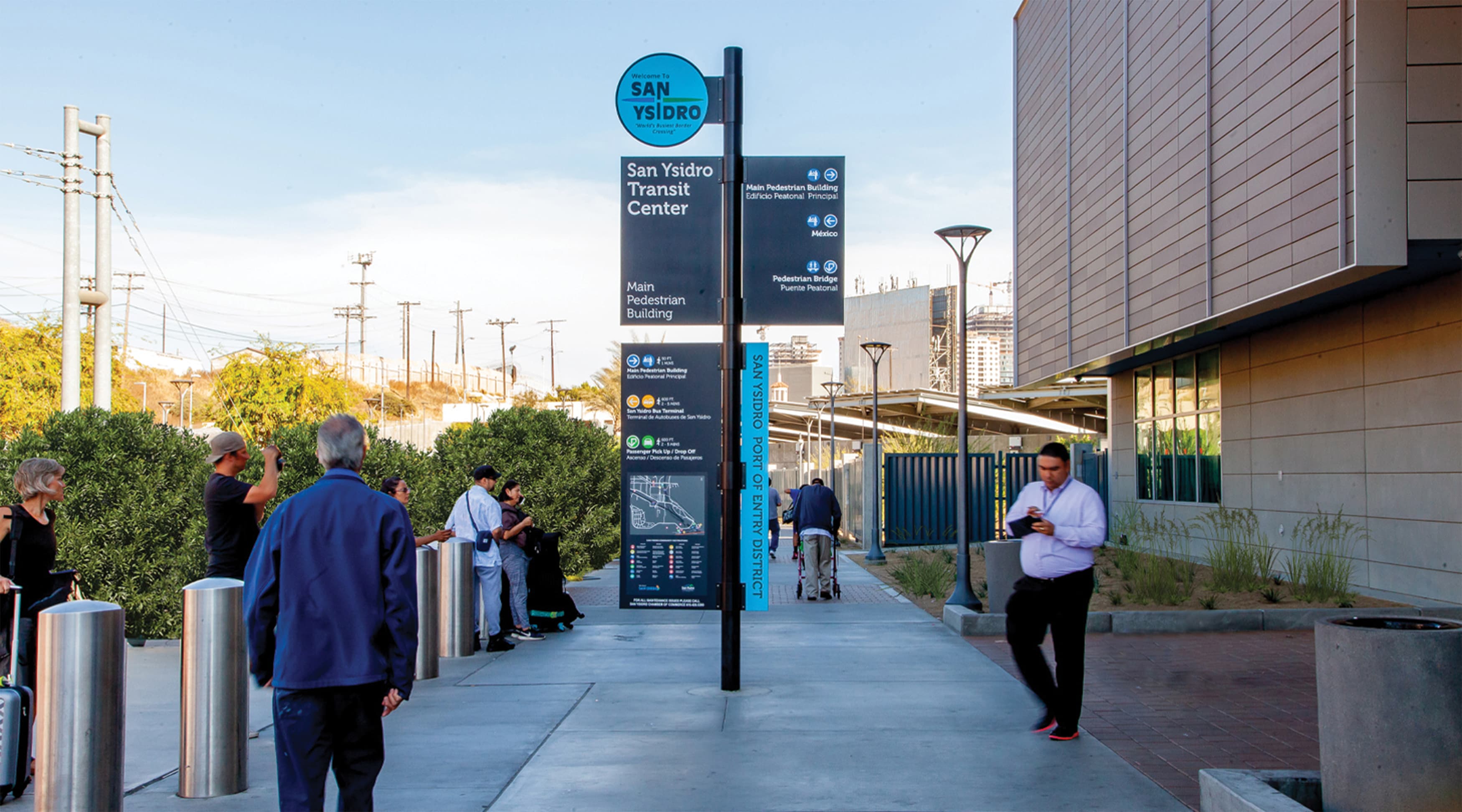
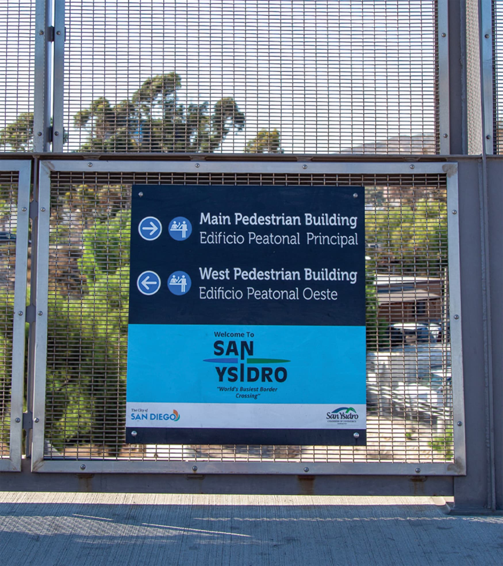
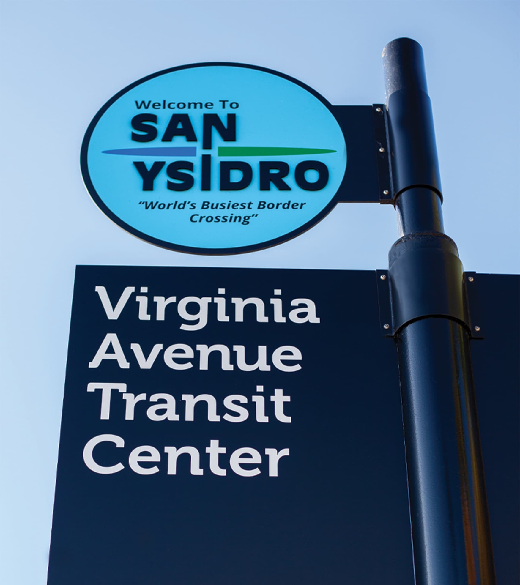
The goal was to reduce friction in the space — to move high volumes of people with simplicity and clarity.
Client
- GSA (General Services Administration) Pacific Rim Region
-

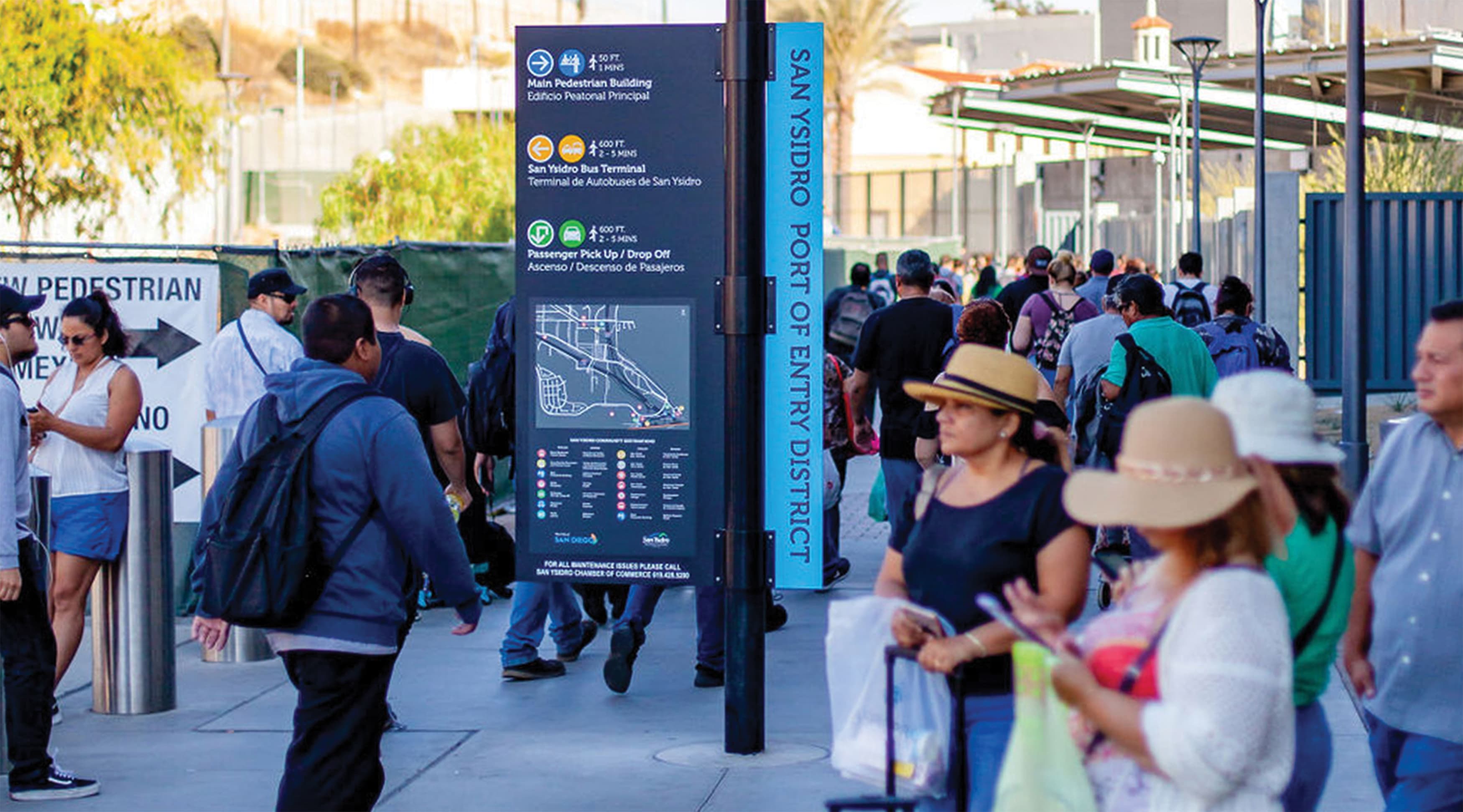
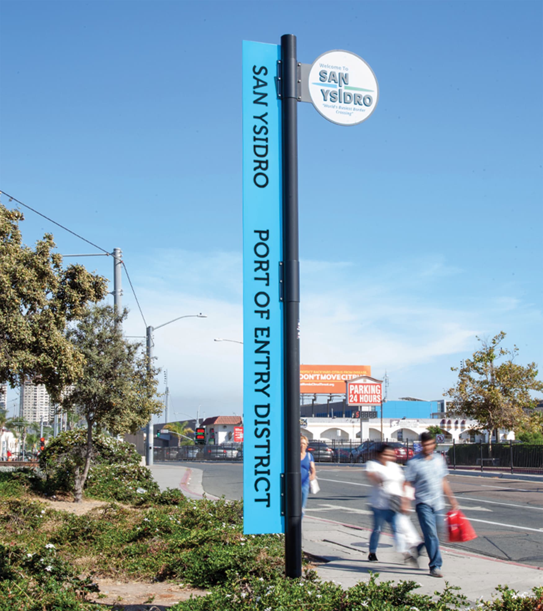
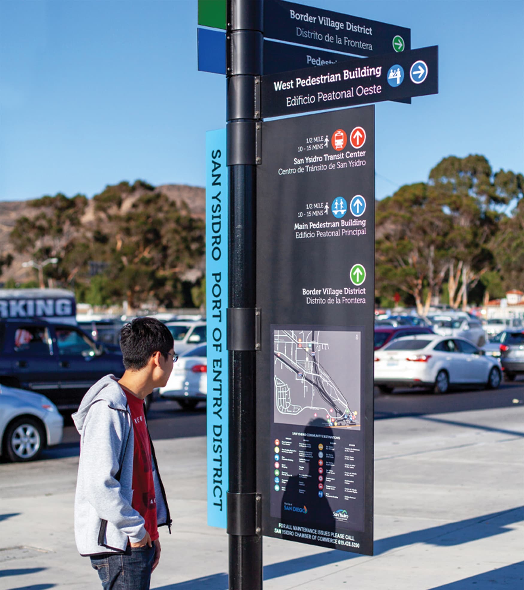
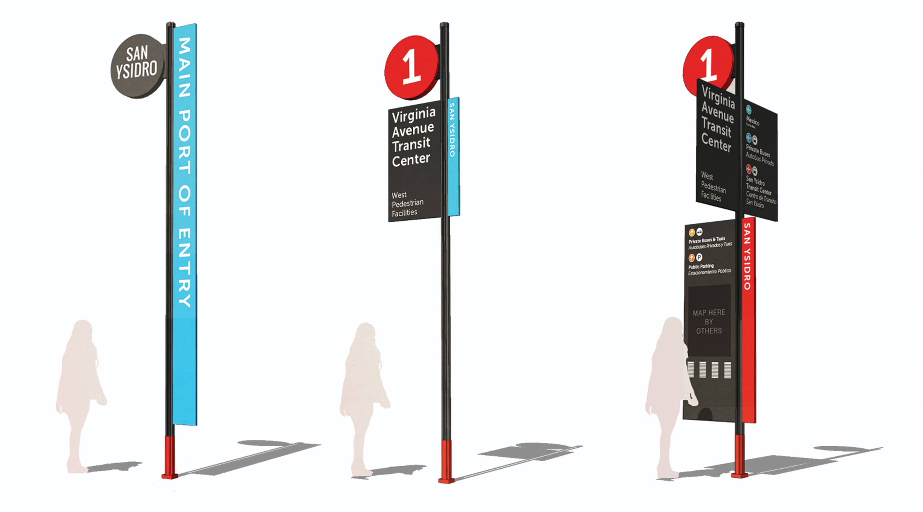
RSM Design worked with U.S. General Services Administration (GSA), local agencies, and community advocates to create a set of signage and wayfinding guidelines that would serve as a road map for developing clear and easy to implement wayfinding from the international border crossing in San Ysidro, California.
RSM Design worked to develop a color-coded set of icons and bilingual information to design a legible and consistent layout for implementation which included the distance and estimated travel times along important pedestrian paths. This information was then placed onto a flexible, durable system of sign designs with a small footprint for a crowded urban environment. The final signage guidelines were published on the GSA website as a resource for future development.

SANDAG, City of San Diego MTS (San Diego MetropolitanTransit System), San Ysidro Chamber of Commerce, CalTrans, Urban Corps of San Diego County